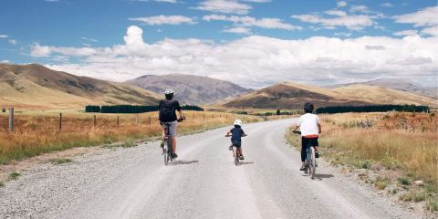
The Alps 2 Ocean Cycle Trail is the longest of the 23 Ngā Haerenga Great Rides of New Zealand serving up epic vistas from Aoraki Mount Cook all the way to arty Ōamaru beside the Pacific Ocean. It is one of New Zealand’s truly Great Rides; the crème de la crème of multi-day cycling experiences in NZ for the iconic southern landscapes traversed and easily navigated by a wide demographic.
The Trail is broken into nine sections. Ride the full length over five to seven days for the depth of experience and huge sense of accomplishment, or pick one or two sections and ride them as day trips from local towns. The variety of terrain means there is a mix of easy to intermediate trail riding.
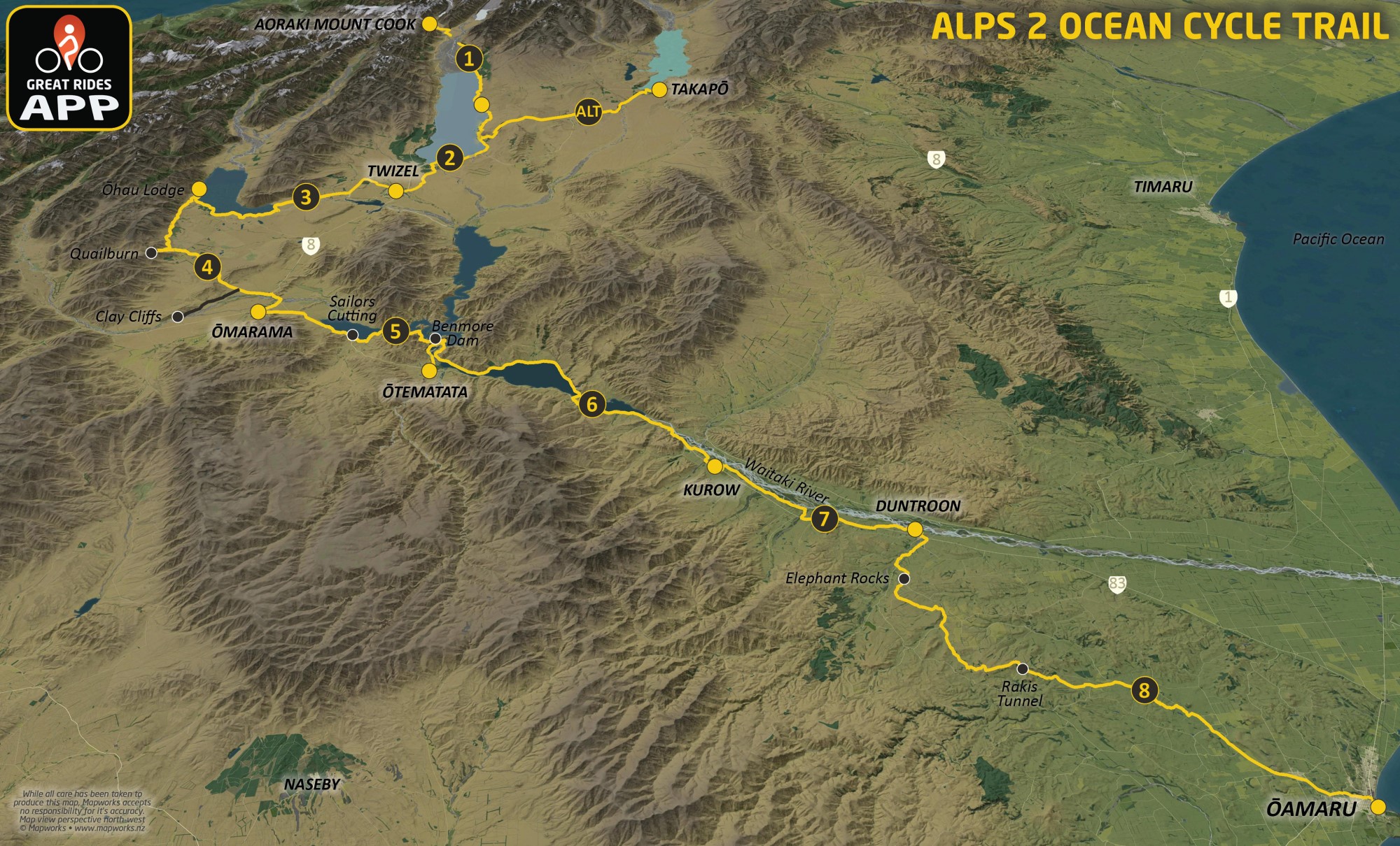
The Cycle Trail starts at the base of the majestic Aoraki Mt Cook in the National Park or alternatively at Takapō, with both routes meeting on the shores of the turquoise waters of Lake Pūkaki. From there the Trail takes in Twizel and the shoreline of Lake Ōhau before climbing to the highest point on the Trail where you view the magnificence of the Mackenzie basin before dropping down to Ōmarama. The Waitaki Valley delivers a geo-park of wonders, you meander past more lakes and rivers, ride through vineyards and experience ever changing vistas on you way towards the Pacific coast. Your final destination is Ōamaru, a town famous for its neo classical 'Ōamaru Stone' Victorian buildings, art galleries and the little blue penguins.
Allow 5-7 days to cycle the entire trail and remember to add some time to investigate the region while you are here. Alternatively, if time is at a premium, simply make a day excursion or tick off a section or two over a long weekend... What better way to reconnect friends and family or simply get away from it all, either way, you will be enjoying genuine hospitality in some of the best scenery that the South Island of New Zealand has to offer.
Whichever option you choose, the Alps 2 Ocean Cycle Trail is sure to be a great destination and a most memorable experience.
Section 1: Aoraki-Mt Cook to Braemar RoadRide from the Southern Alps at Aoraki-Mt Cook National Park, alongside the stunning Lake Pūkaki. Distance: 35km | Fitness: Easy | Skill: Moderate | Traffic: Low | Grade: 2 | 35km | |
Section 2: Braemar Road to TwizelRide the lower reaches of Lake Pūkaki, and across the Pūkaki Flats. Distance: 40km | Fitness: Easy | Skill: Easy | Traffic: Low | Grade: 2 | 40km | |
Alt Route: Lake Takapō to TwizelScenic views of the Southern Alps and across the Mackenzie Basin, riding alongside the Takapō Canal. Distance: 55km | Fitness: Easy | Skill: Easy | Traffic: Low | Grade: 2 | 55km | |
Section 3: Twizel to Lake Ōhau LodgeRide alongside canals and Lake Ōhau foreshore, taking in scenic views of the Southern Alps. Distance: 38km | Fitness: Easy | Skill: Easy | Traffic: Low | Grade: 2 | 38km | |
Section 4: Lake Ōhau Lodge to ŌmaramaTraverse the lower slopes of the Ōhau Range. Distance: 43km | Fitness: Intermediate | Skill: Intermediate | Traffic: Low | Grade: 3 | 43km | |
Section 5: Ōmarama to ŌtematataRide from Ōmarama, on the hills and alongside the foreshore of Lake Benmore. Distance: 35km | Fitness: Intermediate | Skill: Intermediate | Traffic: Low | Grade: 3 | 35km | |
Section 6: Ōtematata to KurowRide alongside the scenic foreshores of Lake Aviemore and Lake Waitaki. Distance: 44km | Fitness: Easy | Skill: Easy | Traffic: High | Grade: 3 | 44km | |
Section 7: Kurow to DuntroonFollow the Waitaki River and environs between Kurow and Duntroon. Distance: 27km | Fitness: Easy | Skill: Easy | Traffic: Low | Grade: 2 | 27km | |
Section 8: Duntroon to ŌamaruRide through rock formations, valleys and former railway routes to Ōamaru. Distance: 54km | Fitness: Intermediate | Skill: Easy | Traffic: Medium | Grade: 3 | 54km |
Trail map
No news found.

 View larger


